

Combine Static GPS Files
nope not Trimble Software, Windows software. Combine multiple GPS files into one file.
NEW ALDOT NTRIP SETTINGS

Old ALDOT connections are going away. See here how to get setup with the new connection.ALDOT – https://aldotcors.dot.state.al.us/SBC…FDOT – https://www.myfloridagps.com/sbc/Acco…
Process points with OPUS xml in Trimble Business Center
I’m back!!!Trimble GNSS Processor https://surveytools.trimbleaccess.com…
TDC600 Creek Topo
#shorts
Edit Point Cloud Elevations in Trimble Business Center
Have you ever needed to adjust the Elevation of a LAS file and make it fit your datum. Well in this video I show you how to use Trimble Business […]
Static on a Rover ONLY Receiver
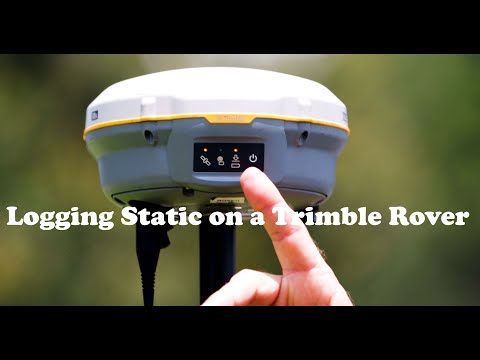
Had a customer trying to log static data on a R2 so I decided to put something together. Seems to be a common occurrence your logging data while flying a […]
Surveying with a SP80 Base and R12 Rover
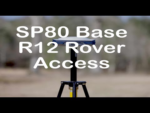
Had someone ask me how well a Spectra SP80 Base would work with a Trimble R12 Rover. Well here is your answer!!
How to Adjust a Fixed Height Tripod
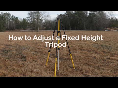
Todays Tuesday Tip How to adjust a fixed height tripod. This is a video I orginally put together for NEI but I thought this would make a great Tuesday tip. […]
Find Control with Google Maps
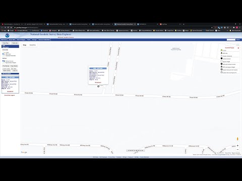
Here is how you create your own map to find your control. Upload your data and create your own map to use on your phone or tablet
Using OPUS in Trimble Business Center

This is how you use a XML file from OPUS to correct the position of your points in Trimble Business Center.